Emergency Status Map
July 4, 2022
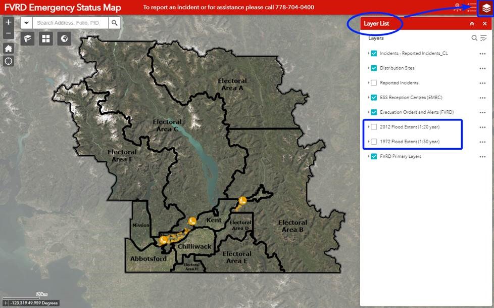
Residents can now use the FVRD Emergency Status Map to view freshet information and historical flood data. The map will be continually updated to reflect current Evacuation Alerts, Orders, and other useful information such as where residents can find sand and sandbags.
Newly added layers in the Emergency Status Map, provided by the Fraser River Basin Council, allow users to view past flood events from 2012 (1 in 20 year flooding) and 1972 (1 in 50 year flooding). Historical data is for informational purposes only. The current forecast does not indicate river levels or flooding to match 2012 or 1972.
To view historical flood data, select the Layer List in the upper right-hand corner of the Emergency Status Map and select the year(s) you want to view.
If you would like to report an incident or need assistance, please call the EOC Public Info Line at 778-704-0400.
Stay Updated
- Follow us @FraserValleyRD on Facebook and Twitter for updates.
- Sign up for Alertable emergency notifications via app, text, email or landline at fvrd.ca/alerts.